OSM tags and method for mapping running track
March 12, 2023 Stardate: 76658.6 Tagged as: OpenStreetMap(OSM)
I recently tried to map a running track at a local high school and forgotten most of the tags and methods which required some research to remind myself again. I know I’ve done this before so wanted to write it down for next time. I didn’t think my scratchpad/user page on the OSM Wiki was sufficient.
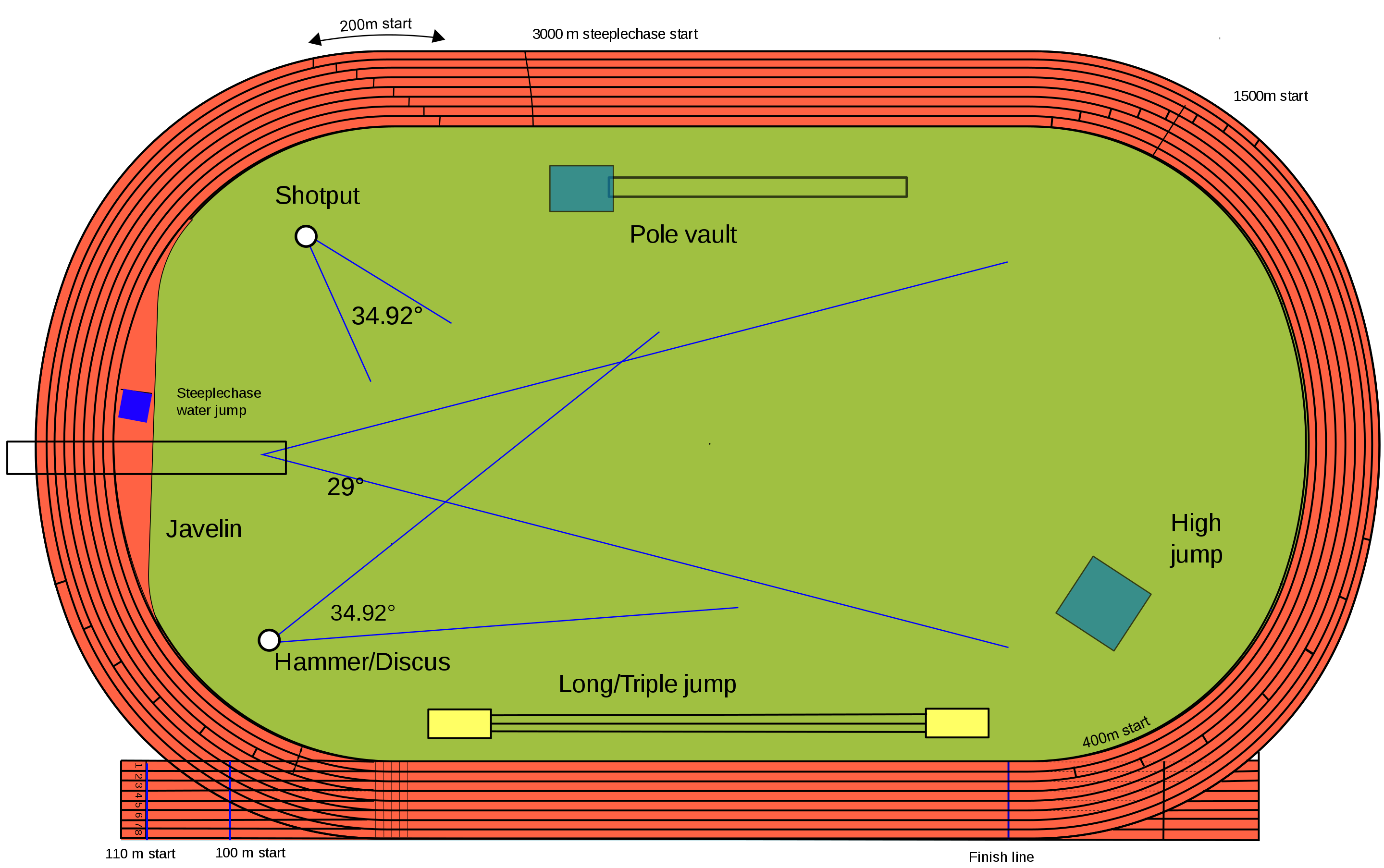
I’m most often mapping in high school track and field areas/stadiums.
Track
Creating multipolygon relation in JOSM = https://blog.mapbox.com/mapping-complex-features-in-josm-using-relations-b930a6aec2c7
Track Wikipage = https://wiki.openstreetmap.org/wiki/Tag:leisure%3Dtrack
leisure=track
sport=athletics
athletics=running
lanes=*
Long Jump Track and Pit
Long Jump Wikipage = https://wiki.openstreetmap.org/wiki/Tag:athletics%3Dlong_jump
Map the track with an area and tag as:
leisure=track
sport=athletics
athletics=long_jump
surface=tartan
lanes=1
area=yes
oneway=no (two pits)
Map the pit(s) with an area and tag as:
leisure=pitch
sport=athletics
athletics=long_jump
surface=sand
Software Versions
This is an automated list of software versions used during the writing of this article.
Software Version Ubuntu 22.04.02 LTS JOSM